Routes / Rivers & small towns
When the river comes over the meadows
Published
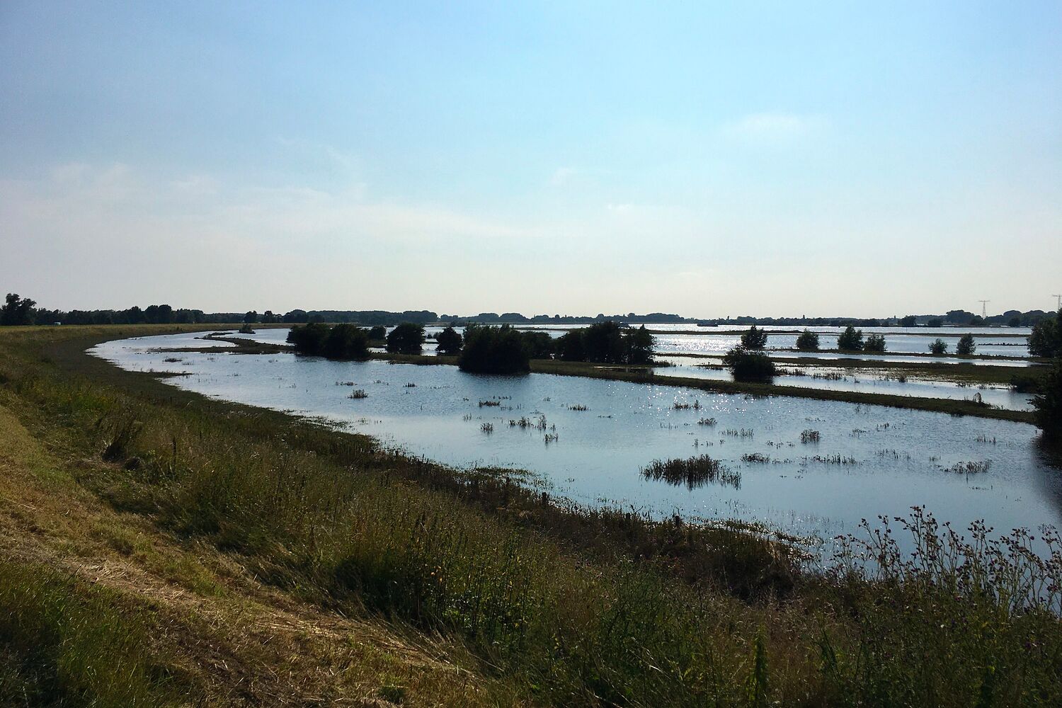
Most of the year I walk down in the floodplains. A few times a year I can't, because they are under water, and then I go and look anyway.
It's a strange sight the first time. Meadows you know as grassland, with paths and gates and cows, have become one big brown-grey lake, with fence posts and hawthorns sticking out and gulls sitting where the cows used to be. The river itself is invisible; you just see the line of trees along its bank, standing in water.
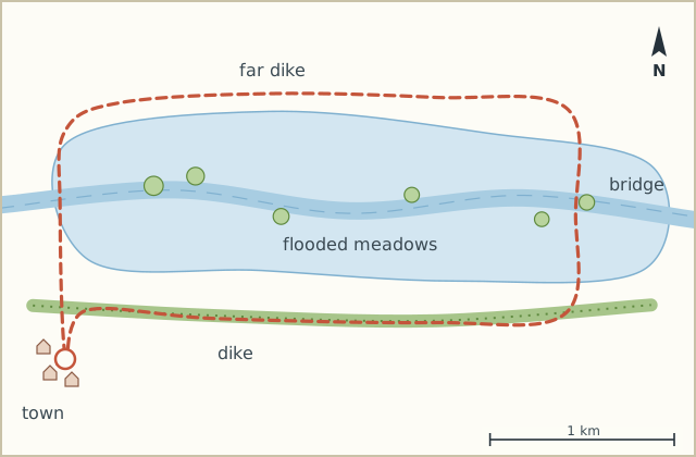
This route is simple: up on the dike on one side, across on the bridge, back on the other dike. It's the high-water version of a walk I normally do lower down. If the water's not high, it is still a nice walk. Just a less dramatic one.
Sketch map
Directions
- From the edge of town climb up onto the dike and turn left, upstream. The floodplain is on your right. (0.4 km)
- Follow the dike top. It's a cycle path here too, keep right. (2.2 km)
- At the stone ramp down into the floodplain (closed when it's flooded) stop and look. The photo is from just here. (2.6 km)
- Carry on along the dike until the road bridge over the river. (3.8 km)
- Cross the bridge on the footway. You get a good view of the water on both sides. (4.5 km)
- On the far side take the steps down and go right, back downstream along the other dike. (6.6 km)
- Cross back over the river on the small footbridge by the old harbour and walk into town. (8.0 km)
Notes
Safety
Never go down into the floodplain when it's flooding. The water rises faster than you think and the paths are invisible. The dikes are made for this, the meadows aren't.
When
Water levels are published by the water authorities. I wait until a day or two after the peak, when the water is still high but the dikes are dry.